Extreme Downpour Expected After Heatwave, Up to 80mm of Rain per Hour on 3rd to 4th
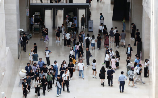
As a heatwave continues, heavy rainfall is forecasted, requiring caution. While a heatwave followed heavy rain in mid-last month, now heavy rain is expected to follow the ongoing heatwave.
The Korea Meteorological Administration forecasts that heavy rain will fall in most parts of the country from the 3rd to the 4th.
According to the Meteorological Administration, Typhoon "Krosa," the 9th typhoon currently passing over the northeastern sea of Tokyo, and the 20th tropical depression located south of Kagoshima, are moving northeast, weakening the ridge of the North Pacific high-pressure system affecting the country.
This high-pressure system is currently being displaced by westerly winds.
On the 3rd, the main body of the North Pacific high-pressure system, located southeast of Japan, is expected to expand its influence southward, bringing large amounts of moisture from the south as Typhoon "Kkomai" leaves a significant amount of vapor in its wake.
Additionally, a weakened temperate depression from Kkomai is predicted to pass over the country from west to east, drawing additional moisture from the Yellow Sea.
High Possibility of Extreme Rainfall Due to Deteriorating Weather Conditions
Currently, the sea surface temperature in the Yellow Sea has reached around 30 degrees Celsius, which is 1 to 3 degrees higher than usual, due to the prolonged heatwave, resulting in a significant supply of moisture to the atmosphere.
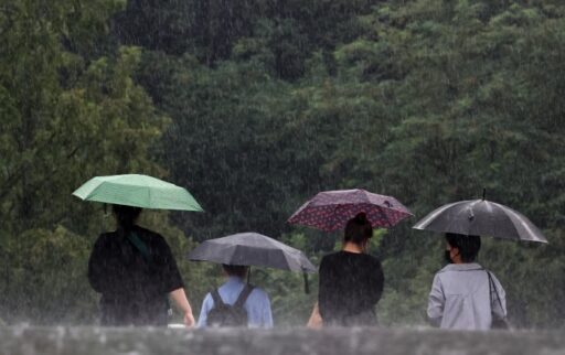
In this situation, dry air from the Tibetan high-pressure system is descending from the north, strongly colliding with the hot and humid air from the south. This will likely lead to heavy rainfall in the western regions and the southern coastline from the 3rd to the 4th.
Starting from the afternoon of the 3rd, the influx of hot and humid air from the south is expected to initiate rainfall in the western regions, with concentrated downpours anticipated between the night of the 3rd and the afternoon of the 4th.
Especially during the nighttime when strong lower-level jet winds at an altitude of about 1.5km intensify, the intensity of rainfall is expected to increase.
During the night as it transitions from the 3rd to the 4th, the maximum precipitation from the incoming hot and humid air is projected to reach around 70mm.
As a result, there may be instances of 'extreme rainfall' pouring down at rates of 50 to 80mm per hour primarily in the metropolitan area and the regions of Chungcheong, Honam, and the southern coast of Gyeongnam.
Total precipitation over the two days of the 3rd and 4th is expected to vary by region.
In Gwangju, Jeonnam, Busan, Ulsan, and Gyeongnam, rainfall is predicted to range from 50 to 150mm (with over 200mm expected on the Jeonnam coast, and over 180mm in the Busan and Gyeongnam southern coast and Jirisan area), while in the metropolitan area, Daejeon, Sejong, Chungnam, and Jeonbuk, 50 to 100mm (with over 150mm at maximum) is expected, and Jeju (excluding the northern part) is likely to receive 30 to 100mm (with mountainous regions estimated at over 120mm).
Continued Heatwave After Heavy Rain, Additional Rain Possible on 6th to 7th
In the western five islands, Gangwon inland, Gangwon mountains, Chungbuk, Daegu, and Gyeongbuk regions, rainfall is forecasted to be between 30 to 80mm (with over 100mm in Gangwon inland, Gangwon mountains, Chungbuk, and northern Gyeongbuk). Ullengdo and Dokdo are expected to receive 20 to 60mm, while the eastern coast of Gangwon and northern Jeju are forecasted for 10 to 40mm of rain.
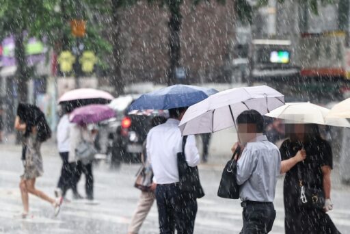
Another round of rainfall is expected on the 6th and 7th.
During this period, hot and humid westerly winds along the edge of the North Pacific high-pressure system are anticipated to collide with cold and dry air descending from the north, forming "band-shaped" rain clouds that can induce heavy rainfall.
This rain cloud band is expected to sweep across the country from the central region to the southern region, bringing substantial rainfall.
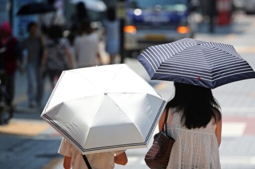
However, even with heavy rainfall, the heatwave is unlikely to dissipate completely.
While areas experiencing heavy rain may see heat advisories lifted temporarily, temperatures are expected to rise quickly again once the rain stops, potentially leading to the issuance of heat advisories once more.
As hot and humid air continues to flow in, the perceived temperature is expected to remain high, and tropical night phenomena are projected to persist.
Image Source: News1

![[Breaking News] Jeong Cheong-rae elected as new leader of the Democratic Party… First ruling party head under Lee Jae-myung’s government](https://wordkorean.com/wp-content/uploads/2025/08/thumbnail-25.jpg)