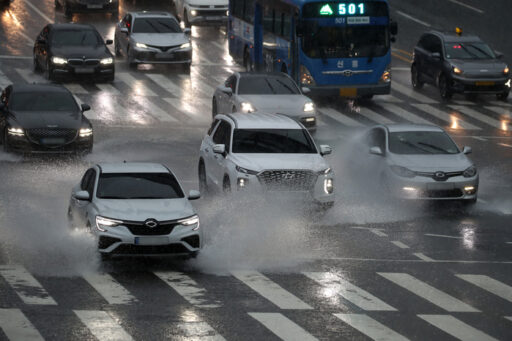
Expected Heavy Rain of Up to 150mm in the Capital Region Midweek
The rain clouds that poured over 260mm of heavy rainfall in the southern coastal area from last weekend to the start of the week are now expected to move north toward the capital region. According to weather forecasts, more than 100mm of rain is expected in the central region, with some areas in the capital region likely to experience heavy rainfall exceeding 150mm.
Heavy Rainfall
Looking at the nationwide rainfall status, on the 13th (Wednesday), rain is expected to fall in most areas of the country, gradually easing from the evening (6 PM to 12 AM).
However, in the central region, rain clouds are expected to linger, continuing precipitation until the 14th (Thursday).
Over the two days in midweek, 50 to 100mm of rain is expected in Seoul, Incheon, and Gyeonggi Province, with more than 150mm of heavy rain possible in northern Gyeonggi and the five islands in the Yellow Sea.
Regional Precipitation Forecasts and Weather Conditions
In the Gangwon Province area, inland and mountainous regions are forecasted to receive 30 to 80mm of rain (with some areas exceeding 100mm), while the eastern coastal area is expected to see 5 to 20mm.
In the Chungcheong region, over 100mm of rain is expected in northern Chungnam, 30 to 80mm in central and northern Chungbuk, and 10 to 60mm in Daejeon, Sejong, southern Chungnam, and southern Chungbuk.
In the southern region, more than 60mm of rain is expected in the southern coast of Jeonnam and Gyeongnam, while areas including Gwangju, Jeonnam, Jeonbuk, Busan, Ulsan, Gyeongnam, Daegu, and Gyeongbuk are forecasted to receive 5 to 40mm of rain.
Jeju Island is also expected to see intermittent rain of 5 to 20mm.
The cause of this rainfall is the stationary front formed by the meeting of cold, dry air coming from the north and moist air rising from the south.
Last weekend and at the beginning of the week, significant rainfall occurred in Jeju and the southern region, particularly in the southern coastal area, due to the influence of this stationary front.
Starting from midweek, the stationary front is expected to move northward, pushed by hot, humid air from the south.
Possibility of Heavy Rain and Regional Variability
On the 13th (Wednesday), a low-pressure system developed along the stationary front is expected to pass through the northern regions, marking the beginning of rain in the central area. Especially as the low-pressure system exits into the East Sea on the evening of the 13th (Wednesday), a strong clash between the cold, dry air from the north and the hot, humid air from the south is anticipated, resulting in even heavier rainfall.
From the afternoon of the 13th (Wednesday) to the morning of the 14th (Thursday), very strong rain of 30 to 50mm per hour is expected, primarily in the capital region.
In the inland and mountainous areas of Gangwon and northern Chungnam, concentrated heavy rainfall of around 30mm per hour is also expected.
The Korea Meteorological Administration predicts significant variability in rainfall amounts by region due to the narrow characteristics of the stationary front.
In the Chungcheong and southern regions, areas may experience temporary easing of rain from early morning to afternoon on the 13th (Wednesday), while the central region may see a lull in rain from the afternoon to nighttime on the 14th (Thursday).
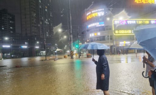
Image Source: News1, on the afternoon of the 3rd, when a heavy rain warning was issued, roads around Sinan Bridge in Unam-dong, Buk-gu, Gwangju were flooded, and Buk-gu public officials were conducting inspections of the site. / Photo provided by Buk-gu, Gwangju